Why Xilab?
Geological mapping has historically been carried out (and is still carried out in many large companies) using paper and spreadsheets. Even geologists; personal computers are often being used as strategic information stores.
This situation makes it necessary to manually transfer data to different data storage and analysis tools, adding errors, loss of traceability, loss of time and, consequently, lack of reliability of the information used for tasks as delicate as geological and geotechnical modelling. In addition, mapping on paper or directly in spreadsheets, makes it impossible to ensure that gathered data accomplish the mapping standard defined by each company.
Xilab was designed by specialist geologists to adapt to the most varied mapping standards, being extremely easy and quick to learn. This ensures its use in different companies, even if they have a high turnover of personnel, eliminating manual data transfers, implementing the traceability of all the operations carried out in the system and, consequently, drastically shortening the time required for a reliable, accurate and efficient process.
Xilab displays and allows interaction with the most varied formats of images and vectors in 2D and 3D, thus allowing the analysis and gathering of information with the use of photogrammetry obtained from different sources, such as images that are captured by drones.

Why choose us
development of software systems oriented to the storage, analysis and digital mapping of geological
information.
With more than 300 active users and more than 15 years of uninterrupted presence in large mining
companies such as Codelco, AMSA and TECK, Xilab ensures reliability, adaptability and efficiency in digital
mapping.

Data gathering
Collect data from drill cores and maps
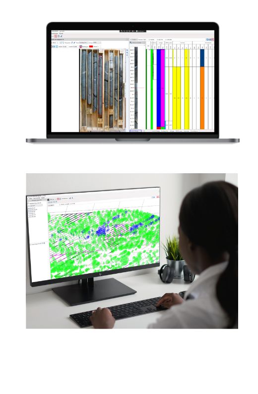
Using Xilab you can collect information about drill cores. You can use the photos of the core boxes as a reference for mapping. You can also collect information in underground or open pit mines such as Litho, structures and any other information that yo need because Xilab is a powerful generic system
- Custom display controlled by display profiles
- Import and export data
- Use of DXF, Images, Obj as support to mapping
Structural DATA
All in one app
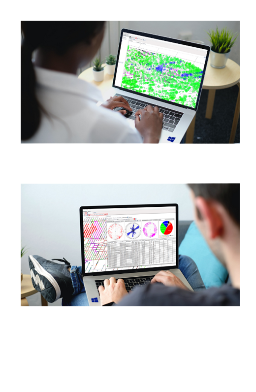
Xilab allows the collection of structural data in a generic way. This allows you to set all the structural variables that need to be captured. The visualization of this data is done in both 2D and 3D views, which allows for more efficient visual analysis. Xilab allows the generation of various structural graphs such as Rosetta, Smith and contours
- Generic variable configuration
- Structural diagram
- Data export


Excavation analysis
Analyze excavation accuracy with Xilab
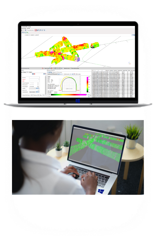
Using digital terrain models and tunnel design values, Xilab, through various mathematical algorithms, determines the accuracy of the excavation.
- Overexcavation and underexcavation calculator
- Color scale display
- Volume calculator